UPDATE 9/27/24 9:00AM: Helene has weakened and is continuing to move north across the southeastern United States. Tropical Storm Warnings have been lifted across East Central Florida, though lingering winds and humidity are expected throughout the day. Wind speeds in the Orlando areas are forecast to range from 20 to 25 mph, with gusts up to 35 mph.
All Walt Disney World theme parks are open as scheduled today, Friday, September 27th.
Despite the windy conditions and minor disruptions caused by Helene, there are no reports of significant damage at the resort.
UPDATE 9/26/24 8:00 pm: A new tornado watch has been issued to include Brevard, Lake, Orange, Osceola, Seminole, and Volusia Counties. This watch remains in effect until 6:00 am on Friday, September 27, 2024.
UPDATE 9/26/24 6:20 pm: Helene’s maximum sustained winds have reached 130 mph and the storm is now a Category 4 Hurricane.
UPDATE 9/26/24 5 pm: With Hurricane Helene rapidly approaching Florida, Walt Disney World has canceled several significant nighttime entertainment events for Thursday evening, September 26, 2024.
Fantasmic! and Wonderful World of Animation at Disney’s Hollywood Studios and Luminous nighttime fireworks at EPCOT have both been canceled so far. Additional updates will appear at the top of this post.
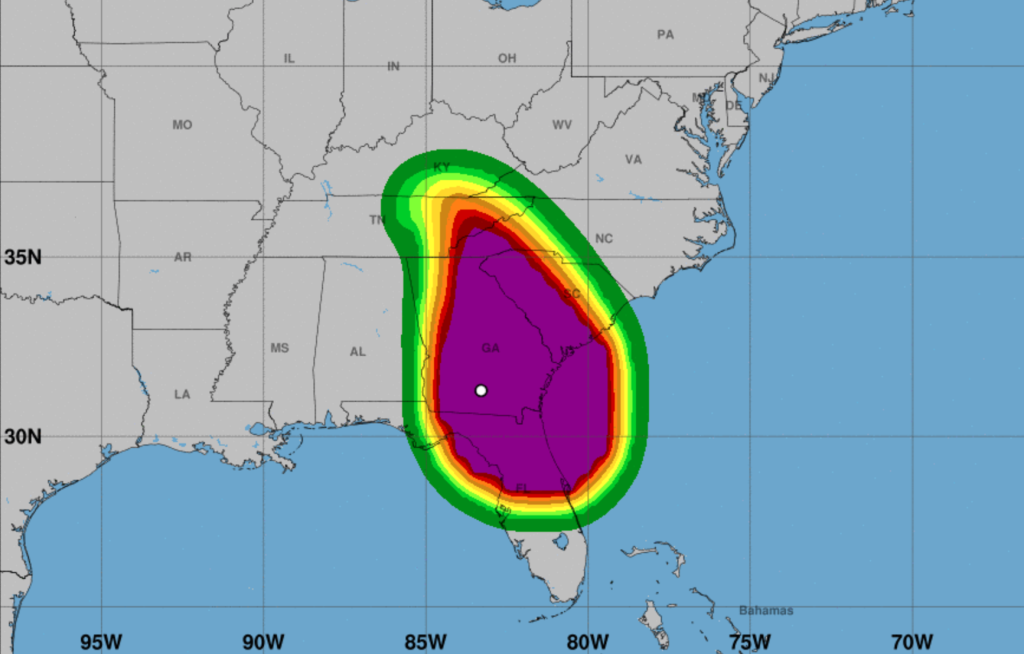
Maximum sustained winds have reached 125 mph with even stronger gusts. Helene is now a Category 3 Hurricane on the Saffir-Simpson Scale (described below). Further strengthening is expected, and Helene will likely become an extremely dangerous Category 4 hurricane at landfall. While weakening is anticipated once Helene moves inland, its rapid forward speed will allow strong, damaging winds—especially in gusts—to spread well inland across the southeastern United States.
UPDATE 9/26/24 2:25 pm: Maximum sustained winds are up to 120 mph just that quickly and Helene is now officially a Category 3.
UPDATE 9/26/24 2 pm: The National Hurricane Center says that Helene is almost a major Hurricane, and additional strengthening is forecast before it makes landfall in the Florida Big Bend. Hurricanes reaching Category 3 and higher are considered major hurricanes because of their potential for significant loss of life and damage. With maximum sustained winds currently at 110 mph, the Hurricane is a Category 2. When winds reach 111 mph, it will become a Category 3. Helene is moving toward the north-northeast near 16 mph, with a significant increase in forward speed expected during the next 24 hours.
The Saffir-Simpson Hurricane Wind Scale classifies hurricanes into five categories based on their sustained wind speed:
- Category 1: Winds 74–95 mph, causing minimal damage to buildings and trees
- Category 2: Winds 96–110 mph, causing significant damage to buildings and trees, and potentially requiring replacement of roofs, doors, and windows
- Category 3: Winds 111–130 mph, causing extensive damage to buildings and trees, and potentially leading to inland flooding
- Category 4: Winds 131–155 mph, causing catastrophic damage to buildings and trees, and potentially leading to complete destruction of mobile homes
- Category 5: Winds greater than 155 mph, causing catastrophic damage to buildings and trees, and potentially leading to complete roof failure on many residential buildings
Halloween Horror Nights Canceled & More Operational Updates at Universal Orlando Resort
Port Canaveral Is CLOSED Until Further Notice

UPDATE 9/26/24 8 am: Hurricane Helene has been upgraded to Category 2, and significant additional strengthening is expected before it makes landfall in Florida. Maximum sustained winds have increased to near 100 mph with higher gusts. Hurricane-force winds extend outward up to 60 miles (95 km) from the center, and tropical-storm-force winds extend outward up to 345 miles.
The risk for several tornadoes will gradually increase today through tonight. The greatest threat is expected from parts of northern Florida into southeast Georgia, the Midlands and Low Country of South Carolina, and southern North Carolina. A tornado watch is in effect until 8 pm Thursday for Brevard, Indian River, Lake, Martin, Okeechobee, Orange, Osceola, Seminole, St. Lucie, and Volusia counties. Walt Disney World is in Orange and Osceola counties.
UPDATE 9/25/24 2:30 pm Eastern: Due to forecasted weather and the impact to the outdoor entertainment offerings, Disney has cancelled Mickey’s Not-So-Scary Halloween Party for tomorrow, Thursday, Sept. 26. Guest tickets will be refunded. While Magic Kingdom was scheduled to close tomorrow at 6 p.m., operating hours will be extended until 8 p.m. for guests to enjoy more time in the park.
Beachcomber Shack (cabanas) and Typhoon Lagoon Umbrella rentals are cancelled for Thursday, September 26.
The following tours and Enchanting Extras Collection experiences are cancelled for Thursday, September 26:
- Savor the Savanna
- Up Close with Rhinos
- Walking with Giants
- Wild Africa Trek
Pools at Disney Resort hotels will continue to operate or close under normal conditions.
UPDATE 9/25/24 10 am Eastern: Tropical Storm Helene has officially become Hurricane Helene with sustained winds at 80mph. Walt Disney World has also posted the following message on its official website.
Due to forecasted weather, Disney’s Typhoon Lagoon water park and miniature golf courses will be closed on Thursday, Sept. 26.
The remainder of Walt Disney World Resort continues to operate under normal conditions. We are closely monitoring the path of Hurricane Helene and will provide updates if changes are made to Mickey’s Not-So-Scary Halloween Party, currently scheduled on Thursday, Sept. 26.

UPDATE 9/24/24 5 pm Eastern: The Tropical Storm Watch has now been upgraded to a Hurricane Watch for the following Florida counties: Bay, Calhoun, Charlotte, Coastal Collier, DeSoto, Gulf, Hardee, inland Hillsborough, Lake, Lee, inland Manatee, eastern Marion Mainland Monroe and Middle Keys (Monroe County), Orange, Osceola, Polk inland Sarasota, Seminole, and Sumter.
UPDATE 9/24/24 2 pm Eastern:
Our latest Futurecast model shows a major hurricane making landfall Thursday night east of the Florida Big Bend area. This is such a large storm there will be tropical storm force wind gusts over most, if not ALL , of Central Florida on Thursday. Stay with #weshwx for updates. pic.twitter.com/KifAP2cDfC
— Tony Mainolfi (@TMainolfiWESH) September 24, 2024
UPDATE 9/24/24 11:30 am Eastern: As the storm intensifies into Tropical Storm Helene, FL Governor Ron DeSantis has increased the number of counties under a state of emergency to include Orange and Osceola, the counties that include the Walt Disney World Resort, bringing the total to 61 ahead of the storm.
Because of the foregoing conditions, which are projected to constitute a major disaster, I declare that a state of emergency exists in Alachua, Baker, Bay, Bradford, Brevard, Calhoun, Charlotte, Citrus, Clay, Collier, Columbia, DeSoto, Dixie, Duval, Escambia, Flagler, Franklin, Gadsden, Gilchrist, Glades, Gulf, Hamilton, Hardee, Hendry, Hernando, Highlands, Hillsborough, Holmes, Jackson, Jefferson, Lafayette, Lake, Lee, Leon, Levy, Liberty, Madison, Manatee, Marion, Monroe, Nassau, Okaloosa, Okeechobee, Orange, Osceola, Pasco, Pinellas, Polk, Putnam, Santa Rosa, Sarasota, Seminole, St. Johns, Sumter, Suwannee, Taylor, Union, Volusia, Wakulla, Walton, and Washington counties.
Ron DeSantis
UPDATE 9/24/24 5 am Eastern: A Tropical Storm Watch has been posted for much of the Central Florida area.
Tropical storm watch posted for much of our area as of the 5am advisory.
— Eric Burris (@EricBurrisWESH) September 24, 2024
This means that tropical storm conditions are possible.
Heads up friends- we'll be getting some nasty weather from PTC9… pic.twitter.com/gLzj7glWdP
On Monday afternoon, Florida Governor Ron DeSantis declared a state of emergency for 41 counties ahead of Potential Tropical Cyclone Nine, which is expected to become Hurricane Helene. While Osceola and Orange Counties (the counties covering Walt Disney World) are not included in the list just yet, it’s important that you keep an eye on any updates, as this information can change at any time.
According to the National Hurricane Center (NHC), this disturbance is forecast to strengthen and be near hurricane strength when it reaches the far northwestern Caribbean Sea Tuesday night.
The system is expected to intensify while it moves northward over the eastern Gulf of Mexico, and it could be a major hurricane when it reaches the northeastern Gulf Coast on Thursday. Although it is too early to specify the exact location and magnitude of impacts, the NHC says there is an increasing risk of damaging hurricane-force winds along portions of the northern and northeastern Gulf Coast, including the Florida Panhandle and portions of the Florida west coast.
We will share updates on this storm and how the weather could affect Central Florida at the top of this post as they come in from the NHC.